Battleton Footbridge remains


Bridge Name: Battleton Footbridge
No.: 15a
Location: Dulverton
Build Date: c18th/19th century

Description: Remains of what was once a footbridge.

The Tithe Map for Dulverton shows an unlabelled feature crossing the River Barle at SS 9126 2754 that may or may not be a bridge. It does not appear on the 1st Edition Ordnance Survey map and presumably had been removed by the time this was surveyed. An historic photograph of the site shows a footbridge built on stone piers with railings along its span.(1)
References:

1.Exmoor National Park HER – MEM 23933

Brushford Bridge

Bridge Name: Brushford Bridge
No.: 17
Location: SS 91275 27689
Build Date: 20th century
Engineer:

Description:
Concrete slabs carried on rsj’s supported on stone abutments with metal parapets. Carries Perry New Road which connects the B3222 with the A396. In 1896 Perry Lane was cut through over the Little Exe and Barle rivers. Further to the East a bridge of the same construction can be found where the road crosses the River Exe.

References:

New Bridge Brushford

Bridge Name: New Bridge Brushford
No.: 16
Location: Grid Reference: SS 9248 2622
Build Date: 1870
Engineer:

Description:
New Bridge is a road bridge over the River Barle, on the former drive to Pixton Park. The drive has now been abandoned. The bridge dates to c1870. It is constructed of coursed local slate stone, with dressed voussoirs stepped out. It is three arch span, with semi-circular outer arches, a larger segmental central arch, and low pointed cutwaters on the south faces. It has chamfered saddle back coping and low square piers at either end of the parapet, obscured by ivy at the time of the survey (July 1985). There are inserted elliptical openings in the centre of the parapets, possibly utilising medieval stone work. The northern parapet is slightly damaged and in need of repointing.The Earl of Carnarvon created this new entrance to Pixton Park when he resited the entrance to the house. A lodge (not included in this list) about 60m to the east is dated 1870.1

References:

1.http://list.english-heritage.org.uk/resultsingle.aspx?uid=1247821

Dulverton Bridge or Barle Bridge

Bridge Name: Dulverton Bridge or Barle Bridge
No.: 15
Location: Dulverton
Build Date: Origins Medieval. Widened in 1819
Engineer: John Stone of Yarcombe (1819 widening)

Description:
References:

1.Civil Engineering Heritage by R.A.Otter
2.Exmoor National Park HER – MSO9331
3.The Ancient Bridges of the South of England – Jervoise
4. Somerset Roads – The Legacy of the Turnpikes – Western Somerset – J B Bentley & B J Murless

Marsh Bridge

Bridge Name: Marsh Bridge
No.: 14
Location: SS 9069 2894
Build Date: C18
Engineer:

Description:
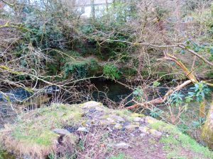
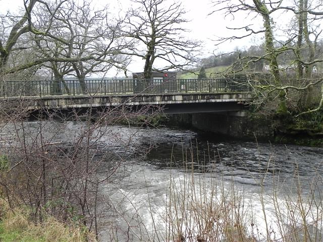
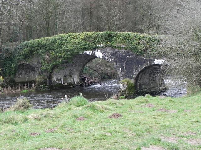
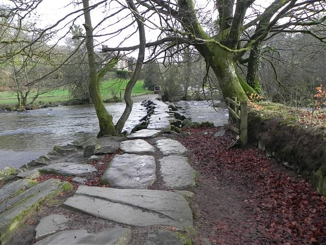
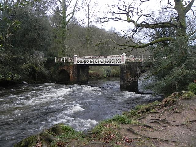
Road bridge over River Barle. Probably C18, repaired 1818-9, altered 1866-7 when central pier removed and iron bridge inserted, parapet destroyed 1952, reconstructed in steel 1979-80. Early C19 repairs by John Stone, mid C19 alterations by County Surveyor, Arthur Whitehead, iron work by Hennet and Spink of Bridgwater. Flat bedded local stone, rubble voussoirs and steel. Plan: semi-circular head arched outer bays, centre spanned by steel bridge resting on pointed cutwater piers. Latticework steel parapet, pyramid topped lattice work piers flanking centre span, recurring motif of St Andrew’s Cross. The original use of cast iron was suggested in 1851 by the preceding County Surveyor Richard Carver. A chapel of ease was erected in the mid C19 on the north bank beside the bridge by John Locke of Northmoor (not included), which burnt down 1909. (Greenfield, Exmoor Review, 1980; photograph in NMR, Buchanan, Batsford Guide to the Archaeology of Central and Southern England, 1980)1
re-built 1866; re-decked 1947; re-built 1979; SCG 9.11.1979;2
Marsh Bridge, a mile or so above Dulverton, is now an iron bridge on stone piers. It bears the date 1865.3

References:

1.Exmoor National Park HER – MSO10831
2.Somerset Roads – The Legacy of the Turnpikes – Western Somerset J B Bentley & B J Murless
3.The Ancient Bridges of the South of England – Jervoise

Thornton’s Bridge

Bridge Name: Thornton’s Bridge
No.: 13
Location: SS 73153 39998
Build Date: circa 1915
Engineer:

Description:
“His favourite spot on Exmoor is just round the corner up above Thornton’s bridge in the Barle valley. He reckons the Barle valley is the most beautiful valley he has ever seen. He’s seen quite a few. On the continent you see lots of river valleys, the Gorge du Tarn and the Aveyron, the Auvergne, the Ardeche, the Vienne and all those places. He doesn’t think you will find anything prettier than the Barle. If you walk up from Marsh Bridge towards Tarr Steps, it’s magical. That’s his favourite place.”1
Named after a Mr H.H.Thornton who built the bridge in his capacity as Secretary of the Devon & Somerset Staghounds for the purpose of riders being able to safely cross the River Barle when the water levels were too high to use the adjoining ford.The bridge was also used to kennel the pack of hounds. 2


Mr.H.G.Thornton 1915

References:
1.Oral history recordings – Tom Yandle – http://www1.somerset.gov.uk/archives/exmoor/yandlesummary3.htm
2.Exmoor Society Newsletter N0.60 Spring 2013

Tarr Steps Clapper Bridge

Bridge Name: Tarr Steps Clapper Bridge
No.: 11
Location: SS 8676 3211
Build Date:

Engineer:

Description:
Tarr Steps Bridge, one of the earliest examples of a stone bridge constructed before the use of the arch became known. It consists of 17 spans, the covering stones being laid flat without mortar or cement on pillars of rough stone placed upon the river bed. The pillars are 4 to 6ft apart and about 3 to 4ft high. Most are spanned by one stone only, the slabs varing from 6 to 8ft long, although one is over 10ft long. The origin of the name is not known.
The middle section of the bridge was carried away by floods in the winter of 1941-2 it was fully restored by Somer Arch Soc and Royal Engineers in 1952, but was again destroyed by floods in August of the same year. The stones were recovered and the bridge was again reconstructed by Royal Engineers.
Tarr Steps (partly in Withypool Parish) Grade 1. An impressive stone ‘clapper’ bridge of an unknown origin. Spans the river Barle. Length 180ft including paved approaches, width 5ft, the piers extending beyond the pathway 5ft on either side. There are 17 openings, the widest in the middle. The horizontal slabs havean average length of 7ft the longest being 8.5ft; there is no mortar or cement. Ancient Monument. Restored following 1952 flood damage.1
Tarr Steps, on the track leading from Winsford to Hawkridge, is a clapper bridge with seventeen spans. The flat stones, or clappers, average about 5 feet in width, while the piers are about 15 feet in width. The total length of the bridge is 180 feet. Although bridges of this type are by no means uncommon, this is one of the finest examples in this country. In sussex the term “clapper” means a plank, and in that county is often used in reference to raised footways along side roads subject to flooding.2

References:

1. Exmoor National Park HER Ref: MSO8673
2. The Ancient Bridges of the South of England – Jervoise

New Bridge (Withypool Bridge )

Bridge Name: New Bridge (Withypool Bridge )
No.: 8
Location: Withypool – SS 845 354
Build Date: 19th century
Engineer:

Description: 1681 – paid to John Leay to the repairing of Wythy Poole Bridge 9s 10d  3
A 19th century six-arched stone road bridge over the River Barle at Withypool, which replaced an earlier bridge some 100m upstream. It was restored in 1866 and 1983. Scheduled monument. Listed grade II
This bridge is not noticed by Jervoise, nor can any other reference to it be traced. The map reference identifies the bridge concerned as that which crosses the River Barle just south of Withypool and is called ‘New Bridge’ on OS 6″ 1962. Road bridge over River Barle, C19, restored in 1866 by John Buslin and William Browner and Son, and in 1983 by Somerset County Council. Flat bedded slate, red sandstone chamfered blocks terminating parapet. Six arch bridge, cutwaters between rising to springers of arches continued as buttresses to just below coping of parapet, dressed flat bedded slat to form saddle back coping, parapets raking back and terminating with buttress piers on north east and south west returns. Date 1983 set in pebbles on breakwater. This bridge replaced an earlier bridge some 100m upstream. Scheduled Ancient Monument (Somerset County No 268).1
Shown on OS map as New Bridge. Road bridge over River Barle. C18, restored in 1866 by John Buslin and William Browner and Son, and in 1983 by Somerset County Council. Flat bedded slate, red sandstone chamfered blocks terminating parapets. Six arch bridge, cutwaters between rising to springers of arches continued as buttresses to just below coping of parapet, dressed flat bedded slate to form saddle back coping, parapets raking back and terminating with buttress piers on north east and south west returns. Date 1983 set in pebbles on breakwater. This bridge replaced an earlier bridge some 100 m upstream. Scheduled Ancient Monument (Somerset County No 268). 2

References:

1.Exmoor National Park HER – MSO8671
2.Exmoor National Park HER – MSO10797
3.An Early Portion of the Church Warden’s accounts of All Saints, Nynehead (1668- 1684).BY W. DE C. PRIDEAUX, L.D.S. ENG., F.R.S.M.