River Heddon rises on Exmoor just outside the Somerset Boundary north east of Parracombe close to Higher Holworthy. Flowing in a generally westerly direction from its source it flows through a steep ravine to pass Holworthy Farm and then Highley Farm to reach the A39 main road. Before passing beneath the A39, it is joined by a stream of equal size which rises near Holwell Barrow. After passing through the A39 Culvert, the river turns to a north easterly flow to reach Parracombe. From Parracombe it flows through a gorse lined valley to flow beneath Skillaton Bridge and on to Heddon Valley Mill.
From Heddon Valley Mill, the river takes a more northerly direction and flows through a series of cascades to reach Mill Farm. Flowing on through the valley between Heale Wood and Mill Wood, it passes Tucking Mill to reach the Hunter’s Inn. Flowing beneath Martinhoe Bridge it is joined by a substantial stream from Trentishoe, and then flowing to the east of Heddon’s Mouth Wood and Heddon’s Mouth Cleeve it arrives at Heddon’s Mouth and the sea.
It travels approximately 9 kilometres from source to the sea with an elevation fall of close to 360 metres.
Source: Elevation 366.4 m or 1202.0 feet – Location :51.18242,-3.87351
Hawkcombe Water rises at Hawkcombe Head high on Porlock Common at an elevation of close to 1350 feet. Flowing easterly through a steep sided combe it reaches its confluence with waters that flow through Shillett Combe. Flowing on through Homebush Wood it reaches Hawkcombe, from where the flow turns to the north before it reaches Porlock where it is culverted to run beneath the main road. From Porlock the waters continue in a northerly direction to reach Porlock Salt Marsh and then the sea. From source to sea the waters journey is close to 6.5 kilometres.
Source: Elevation 411.8 m or 1351.0 feet- Location :51.19858,-3.65403
The source of the River Haddeo is a spring close to Yellands (Latitude: 51.0736 / 51°4’24″N Longitude: -3.4302 / 3°25’48″W.)’ From its source the river flows through Cuckold’s Combe, past Moorhouse Moor to reach Bridge End and then after a journey of 3.75 kilometres it reaches Wimbleball Lake. In 1979 a dam was constructed to impound the river’s water and Wimbleball Lake was formed. The original course of the river is now below the lake and its exit from the dam is now 6 kilometres from the river’s source.
From the dam the river flows through Hartford flowing beneath Mutton Pie Bridge, a stone clapper bridge. Still in Hartford the river’s waters are used by Exmoor Fisheries to farm rainbow and blue trout for restocking trout lakes. Flowing through Hartford Bottom it reaches Bury after a journey of 10.5 kilometres. At Bury it flows beneath a medieval stone packhorse bridge of four arches and from there it flows east of Bury Cleave and Bury Castle to flow beneath the A396 at Dyehouse bridge to reach its confluence with the River Exe.
Its total journey from source to the Exe confluence is approximately 12.5 kilometres, and falling close to 200 metres.
There are three tributary streams extending down from the surrounding farmland to merge with the River Haddeo including the River Pulham, which passes the village of Brompton Regis and continues to Hartford where it joins the Haddeo.
Farley Water rises on Exe Plain near Little Buscombe at approximately 430 metres (1400 feet) above sea level. Flowing in a north easterly direction in the valley between Exe Plain and Hoar Tor it reaches the county boundary to flow into Devon. It then flows in a more northerly direction and is joined by tributary streams from Clannon Ball and then Holcombe Burrows. Flowing on past Pig Hill on its East side and Cheriton Ridge on its west side it reaches Middle Hill and Farley Hill, here it is joined by tributary streams that originate on the edges of Brendon common before flowing down between Pig Hill and Middle Hill, and Middle Hill and Farley Hill. It flows on through Lawn Wood and Longclose Wood to the west of Farley Water Farm, and then Sanctuary Wood to the east of Cheriton to reach the small hamlet of Bridge Ball. From Bridge Ball it flows through South Close Wood and Lower North Ground Wood to reach Hillsford Bridge where it joins with Hoar Oak Water.
From its source to the confluence with Hoar Oak Water the distance is approximately 6.3 kilometres with a fall of close to 210 metres.
Source: Elevation 429.3 m or 1408.6 feet – Location :51.16685,-3.77091
This text deals specifically with that part of the River Exe that flows through Exmoor. The river begins its journey at Exe Head at an elevation of 458 metres. It flows in a easterly direction through the mires of Exe Plain to Exe Head Bridge which carries the B3223, the Lynmouth to Simonsbath Road. Continuing in a easterly direction it flows through Prayway Meads in the moorland valley between Great Buscombe to the North and Little Ashcombe to the south before flowing beneath Warren Bridge, a single arch stone bridge. Flowing on through the fern clad hills of Exe Cleave, and after receiving water from Rams Combe and Sparcombe Water the river reaches Westermill Farm, and soon after flows beneath Silly Bridge to reach Riscombe where it turns to a south easterly direction to meet with Allcombe Water and Greenland Water. These two waters flow down Swincombe Cleve from origins on Wellshead Allotment. The river continues on past Edgcott, where Edgcott Water joins before reaching Exford. From source to Exford the river has travelled close to twelve kilometres with an elevation drop of 200 metres.
Exe Head
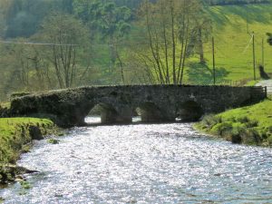
At Exford it flows beneath Exford Bridge, a listed three arch structure and continues past Southcott and through the pastures on the edge of Lyncombe Wood to reach Lyncombe farm where it flows beneath a splendid 17th century single arch humpbacked packhorse bridge which once carried a now abandoned track over Staddon Hill. From Lyncombe the river takes a southerly course and flows to the west of Lyncombe Hill through Curr Cleave to reach Nethercote and continues on below Bye Common to Larcombe Foot where it receives the waters of Larcombe Brook which flow down from origins on Staddon Hill. The river then flows through the valley at the foot of Bye Hill and after a journey of close to 21 kilometres it arrives in Winsford.
Lyncombe Bridge
At Winsford it receives the waters from Winn Brook and flows beneath three bridges, the first being a medieval two arch packhorse bridge restored in 1952, the second is Vicarage Bridge, a three-arched road bridge built in 1835 for the turnpike, which was strengthened and widened in 1928. The third bridge was built in 1952 on the site of an old arch bridge destroyed in the 1952 floods. To the south of Winsford the river flows beneath Edbrooke Bridge, an ancient two arched packhorse bridge rebuilt in the 18th century, it once carried the road to Winsford until the new turnpike road was made in 1824. From Edbrooke the river flows through a wooded valley which runs between West Howe Hill and Edbrooke Hill to reach Coppleham where it flows beneath Week Bridge, a single arch reinforced concrete bridge, built in 1927 and designed by Edward Stead. Just a short distance past Week Bridge the waters of the river Quarme which originate on Hoar Moor join the flow.
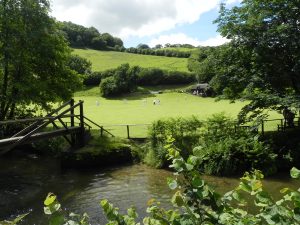
Bridgetown Cricket Green
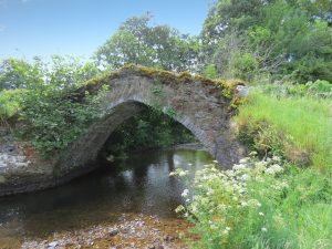
Continuing a southerly direction the river flows to the west of Exton where there is an 19th century weir and leat that powered the waterwheel of Bridgetown corn mill, the grounds of which are now used as a campsite. Passing beneath Bridgetown Bridge the river flows past Bridgetown cricket green to reach Milton’s Bridge. The river continues between Broford and Howe Woods where waters that originate near Stolford Hill Cross join, and continues on past Winslade Wood to Kent’s Weir which provided power via a leat to Kents Mill constructed in the 19th century. Flowing beneath the humpback Chilly Bridge the river continues through wooded valleys and passes close to the remains of Barlynch Priory, founded c.1175 and dissolved c.1537. After travelling close to 34 kilometres the river arrives at the medieval three arched Hele Bridge.
Hele Bridge
Just beyond Hele bridge a weir provided power via a leat to Weir Saw Mill and after passing beneath Weir bridge the river is joined by the waters of the River Haddeo and then by the waters of the River Barle before reaching Exebridge. The Rivers journey from source to Exebridge is approximately 37 kilometres with a fall in elevation of close to 340 metres.
Source: 457.9 m or 1502.4 feet – Location :51.15831,-3.78638
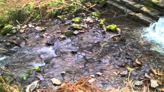
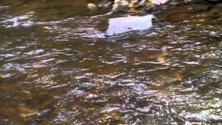
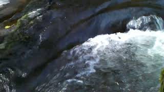
Click the button below to watch a playlist of videos showing the river’s journey from source to confluence with the River Barle. A gallery of the individual playlist videos is also shown.
Embercombe Water rises on Embercombe Head on Wilmersham Common at an elevation of approximately 420 metres above seal level. It flows in north easterly direction through Ember Combe to join Chetsford Water. The confluence of Embercombe Water and Chetsford Water creates Nutscale Water. A total distance of approximately 0.7 miles from source to the join with Chetsford Water.
Source: Elevation 421.5 m or 1382.9 feet – Location :51.16229,-3.63278
East Water is a tributary stream of Horner Water. It rises on Goosemoor Common on the northern slopes of Dunkery. Flowing through Bagley Combe its joined by waters from Sweetworthy Combe and south of Cloutsham by waters from Aller Combe. The waters then flow in an easterly direction to Cloutsham Splash and Old Bridge, shortly after which further waters join from Hollow Combe. From Hollow Combe the waters flow in a northerly direction through Sideways Wood where additional waters join from Red Girt. After a journey of approximately 4 kilometres the waters join those of Horner Water to flow on to reach the sea at Bossington. The fall in elevation from its source to the Horner cnfluence is close to 330 metres.
Source: Elevation 446.9 m or 1466.2 feet – Location :51.16641,-3.60876
The East Lyn is formed by the confluence of Oare Water and Badgworthy water below Malmsmead, it then flows for 7.5 kilometres through Brendon and Rockford to reach Watersmeet where it is joined by Hoar Oak Water. Continuing on, the river flows through a deep narrow gorge to reach Lynmouth where immediately after flowing beneath Lyndale bridge it is joined by the waters of the West Lyn river and shortly after flows into the Bristol Channel.
From its beginning at the confluence of Oare Water and Badgworthy Water the East Lyn flows for an approximate distance of 10.8 klometres to reach the sea at Lynmouth with a fall of close to 250 metres. The waters begin at the source of Badgworthy Water giving a total distance from source 16.4 kilometres.
Source: Head stream on Little Buscombe – Elevation 435.2 m or 1427.7 feet – Location :51.16534,-3.76145
Danes Brook starts its life as Litton Water which rises near Sandway Cross. It flows in an easterly direction to reach Uppper Willingford Bridge where it is joined by waters running down from close to Withypool Cross. It is at this point that it becomes Danes Brook.
From Upper Willingford Bridge it flows in a south easterly direction to flow beneath Lower Willingford Bridge and then on past Cloggs Farm, Wester Shircombe and Shircombe Farm. Turning south past Shircomb Brake, Zeal Brake and Zeals Farm to reach Slade Bridge at the foot of Anstey Common and then on through Hawkridge Ridge Woods to finally flow beneath Castle Bridge just before its confluence with the River Barle.
Danes Brook flows for an approximate distance of approximately 12.4 kilometres from source to mouth with an elevation fall of close to 205 metres.
Source: 391.1 m or 1283.2 feet – Location :51.08479,-3.72597
Chetsford Water rises close to Alderman\’s Barrow at an approximately elevation of 430 metres above sea level. It flows past Hurdle Down in a south easterly direction for approximately 1 kilometre to reach Chetsford Bridge which lies on the moorland road between Porlock Hill and Exford. It then flows in a north easterly direction to join with Embercombe Water to create Nutscale Water. The total distance from source to the confluence with Embercombe Water is approximately 2 kilometres and its waters reach the sea after flowing through Nutscale and Horner Water after a journey of approximately 15 kilometres
Source: 434.8 m or 1426.4 feet – Location :51.16980,-3.66236
Chetsford Bridge
Video Gallery
Chetsford Water flowing beneath Chetsford Bridge
View More