River Quarme

The river rises on Hoar Moor just north of Hillhead Cross at an approximate elevation of 450 metres and flows in an easterly direction through Codsend Moor and Codsend and ­on to Luckwell Bridge where the river turns and flows in a southerly direction through the valley on the western side of Quarme Hill to join the river Exe just south of Coppleham. Its journey from source to the River Exe confluence is approximately 12.5 kilometres with a fall in elevation of approximately 270 metres.

Source: Elevation 450.6 m or 1478.3 feet- Location :51.15733,-3.63078
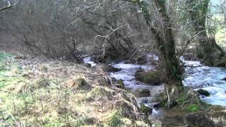
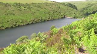
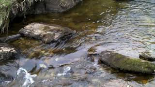
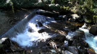
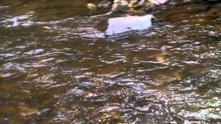
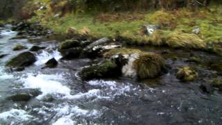
Confluence with River Exe


Video Gallery


Image Gallery Location Map Structures 


Pill River

Pill River rises on Monkslade Common at an elevation of 279 metres and flows in a generally north easterly direction to flow through Rodhuish, and Whitley Brake to reach Bilbrook. It flows through Bilbrook Ford before turning north to reach Black Monkey Bridge. It flows beneath the West Somerset Railway to reach Binham Farm. Continuing in a northerly direction it flows through Home Farm before flowing beneath Pill Bridge to reach the sea at Blue Anchor. From the Source on the Monkslade Common the rivers length is approximately 7.5 kilometres.

Source: Elevation 278.8 m or 914.6 feet – Location :51.14188,-3.43255

Pill River Outfall
Pill River Outfall

Video Gallery


Image Gallery Location Map  Structures 


River Pulham

A tributary of the River Haddeo, it rises on Quarme Hill near Heath Pault Cross and flows in a southerly direction on the east side of Exton Hill and on through Brompton Regis. Just south of Brompton Regis after passing Pulham Mill it is joined by a tributary stream that originates on Goosemoor which runs down through Kings Brompton Forest on the western side of Blagdon Hill, The combined flow continues to Hartford where it joins the Haddeo. The river flows for a distance of approximately 9 kilometres with a fall in elevation of close to 195 metres from source to the confluence with the river Haddeo.

Source: Elevation 379.6 m or 1245.5 feet – Location :51.11982,-3.51207

Upstream from Confluence with River Haddeo

Video Gallery


Image Gallery Location Map  Structures 

Oare Water

Oare Water flows for a distance of 3 kilometres and is formed from the combined waters of Chalk Water and Weir Water which join at Oareford Bridge. It continues on through Oareford and Raw Combe where further waters join. After flowing beneath Oare bridge it reaches Oaremead farm and meets Badgworthy Water close to Malmsmead to form the East Lyn River.

Source: Using Weir Water source: Elevation 436.0 m or 1430.3 feet Location :51.17615,-3.65884

Oare Bridge downstream arch
Oare Bridge


Image Gallery Location Map  Structures 


Nutscale Water

Nutscale Water is created by the combined flows of Chetsford Water and Embercombe Water. From its source Nutscale Water flows in a north easterly direction to reach Nutscale Reservoir which was created in 1942 by the construction of a dam. From the dam the waters flow in a northerly direction  through the valley between Tar Ball Hill and Babe Hill. After approximately 2000 metres it changes direction to south westerly and continues to the south side of Ley Hill. At some point in its journey, probably near to Pool bridge where the waters from Pool Combe join, it changes name to Horner Water.

Its journey from Embercombe to Pool bridge is approximately 4.5 kilometres with a fall in elevation of close to 110 metres and together with the waters of Chetsford and Horner the journey to the sea is approximately 15 kilometres.

Source: 434.8 m or 1426.4 feet – Location :51.16980,-3.66236


Pool Bridge upstream arch
Pool Bridge

Video Gallery


Image Gallery Location Map 

Litton Water

Litton Water is the head waters of Danes Brook., one of the main tributaries of the River Barle.. The source of Litton Water is near the Sportsman’s Inn at Sandyway Cross. From the source it flows in a generally south easterly direction flowing below Twitchen Ridge to reach Upper Willingford Bridge where it is joined by waters that originate in Willingford  to form Danes Brook. From its source to Upper Willingford bridge it travels approximately 2.6 kilometres with an elevation fall of 60 metres and together with Danes Brook the waters reach the Barle after a journey of 12.4 kilometres with an elevation fall of close to 205 metres.

Source: 391.1 m or 1283.2 feet – Location :51.08479,-3.72597

Small weir upstream from Willingford Farm


Image Gallery Location Map 

Kinsford Water

Kinsford Water are the head waters of Sherdon Water, one of the main tributaries of the River Barle.. The source of Kinsford Water is on Comerslade just above Kinsford gate. From the source it flows for a distance of 6 kilometres in a generally south easterly direction flowing below Hangley Cleave to reach Long Holcombe where waters join to  form Sherdon Water. The elevation fall from source to Long Holcombe is close to 120 metres. The waters of Sherdon Water continue on for another 4 kilometres to reach the River Barle.

Source: Elevation 447.6 m or 1468.5 feet – Location :51.12014,-3.80557

Valley below Wintershead Farm

Video Gallery


Image Gallery Location Map 

Horner Water

The River Horner also known as Horner Water is a continuation of the waters of Chetsford Water, Nutscale Reservoir and Nutscale Water and starts its life at Pool bridge in Horner Woods. Horner Woods is one of the largest and most beautiful ancient oak woods in Britain, a National Nature Reserve nestled on the Holnicote Estate and become one of woodlands of the “Queen’s Green Canopy” dedicated to the Queen at the Platinum Jubilee in 2022. It flows in a generally northerly direction through Horner Wood and on the west side of Horner Hill where it is joined by East Water before reaching Horner and West Luccombe. It continues on beneath New Bridge and flows through Breakneck Woods to reach Bossington. At Bossington it is joined by the river Aller before reaching Bossingto Beach where it flows into Porlock Bay near Hurlestone point on the Bristol Channel.

From Pool bridge the river flows for a distance of 8.5 kilometres to reach the sea at Bossington Beach and from the Chetsford Water source it 15 Kilometres.

Source: Elevation 434.8 m or 1426.4 feet – Location :51.16980,-3.66236


Horner Bridge Downstream Arch
Horner Bridge

Vudeo Gallery


Image Gallery Location Map  Structures 

Hoccombe Water

A 2.6 kilometre long tributary of Badgworthy Water, it’s source is on Lanacombe close to Brendon Two Gates. It flows in a generally easterly direction south of Hoccombe Hill and is joined by a tributary stream that flows down the valley between Lanacombe and Trout Hill. It joins Badgworthy Water in the valley between Badgworthy Hill and Trout Hill. The elevation fall from source to the confluence with Badgworthy Water is close to 105 metres.

Source: Elevation 418.7 m or 1373.7 feet – Location :51.17526,-3.76746

Confluence with Badgworthy Water

Video Gallery


Image Gallery Location Map 

Hoar Oak Water

Moorland tributary of the East Lyn river, it rises at Hoaroak Hill in the Chains, close to the Tarka Trail. From it’s source it flows east through Long Chains Combe and then north through the valley between Exe Plain and Hoaroak Hill and flows on into Devon over the county boundary at Hoar Oak Tree. It continues in a generally northerly direction past Furzehill Common and Cheriton Ridge. It continues on the western side of Cheriton and combines with Farley Water at Hillsford Bridge before joining the East Lyn river at Watersmeet.

Its journey from source to the confluence with Farley Water is 8 kilometres, and 9 kilometres to Watersmeet and the confluence with the East Lyn River. Elevation fall from source to East Lyn confluence is close to 335 metres.

Source: Elevation 460.7 m or 1511.6 feet – Location :51.16811,-3.80265

Long Chains Combe from Exe Plain

Video Gallery


Image Gallery Location Map Structures