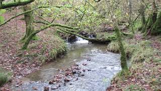
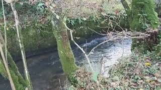
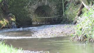
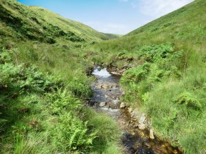
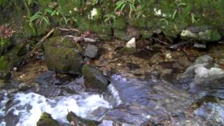
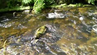
The River Brockey rises on Hawtree Moors near Oldways End before flowing through Coronation Plantation to reach Venn Farm where it flows beneath the disused Devon and Somerset Railway track. It continues on to reach Beer Lane Ford and then through Poole Bottom to reach Harrifords Bridge where it takes a more easterly direction. After flowing through Cale Wood it reaches Nightcott Bridge and then flows past Butterwell Copse and Quick Moor to Nutsford Bridge. It continues through Beer Wood and flows beneath Combe Bridge to reach the outskirts of Brushford where it flows beneath Church Bridge.It then again flows beneath the Devon and Somerset Railway to reach Bowdens and then Kents Hill Pond. After flowing beneath Brocks Bridge it skirts Hele Manor and turns south to reach its confluence with the River Exe a short distance downstream from Exebridge. The rivers length from source to the Exe confluence is approximately 5.8 miles with an elevation fall of close to 120 metres.
The River Brockey lies on the very edge of the Exmoor National Park and whilst strictly not within the bounds of the Exmoor National Park I have included this within the Exmoor Waters listing.
Source: Elevation 233.9 m or 767.3 feet – Location :51.01236,-3.60885
West Water is a tributary of the River Barle, It joins the Barle upstream from Tarr Steps. It rises on the slopes of Worth Hill near Withypool and flows on through Worth to reach Westwater Farm and then flows through North Barton Wood to reach its confluence with the Barle. Its journey from source to the Barle is approximately 3.6 kilometres with a fall in elevation of close to 125 metres.
Source: Elevation 360.1 m or 1181.3 feet – Location :51.09228,-3.67145
Long Chains Combe is a short valley located high on Exmoor in the area known as the “Chains”. Its waters are the source of the headwaters of Hoar Oak Water. After flowing for approximately 1 kilometre it is joined by additional headwaters flowing from the Chains Valley.
Source: Elevation 460.7 m or 1511.6 feet – Location :51.16811,-3.80265
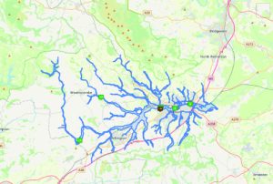
From its source to the confluence with the River Parrett, the river is about 63km long and falls 367 metres. The two main sources of water form two significant valleys, one rises at Beverton Pond in Huish Champflower and is considered to be the source of the Tone. A second stream, rising in Elworthy parish, was in the 13th century known as the Tan, which may dispute Beverton Pond as the source. Beverton Pond is located in the Brendon Hills on the very edge of Exmoor National Park and from this point the river flows southeast through a wooded narrow valley into Clatworthy reservoir. The reservoir was built between 1957 and 1959 and officially opened in 1961, the lake has a surface area of approximately 49 hectares. It is around 3 kilometres from the Tone’s source with a drop in elevation of close to 137 metres.
From the reservoir the river flows south past the settlement of Huish Champflower, and continues south for 12 kilometres within a steep sided wooded valley to flow beneath Waterrow bridge where the river’s elevation is now 146 metres. It’s course continues south and flows beneath the remains of the Tone Viaduct built by Brunel in 1870 to carry the Great Western Railway and then flows beneath Hagley Bridge and Tuck Bridge to reach Stawley Mill. After Stawley the river arrives at Tracebridge where there was a slate quarry. The slate was transported via a small tramway which ran through a tunnel from the quarry to the River Tone. A weir was constructed c.1894 and a short leat ran from the river to a slate cutting sheds and a low breast waterwheel which provided the power for four sawbeds and planing machine which survived until 1940. (Eric Rodwell Tracebridge. A History of the Hamlet, its Houses, The Quarries and the Mill.)
After a journey of close to 20 kilometres the river changes course and turns north to flow past Cothay Manor and beneath Greenham bridge, the elevation here is now close to 80 metres. After flowing north for approximately 4 kilometres the river’s course turns to a generally easterly direction at Lutley Bridge, and meanders through open fields past Wellisford Manor and Harpford bridge, and having now travelled around 30 kilometres reaches Tone. The river at Tone was used by the Fox family for almost 200 years to provide the power for Tone Works which was used as the cloth finishing and dyeing works for Tonedale Mills.
Continuing its easterly direction the river flows beneath the impressive Nynehead Court three arched bridge, an English Heritage listed building before reaching the old Aqueduct that once carried the Grand Western Canal across the river. After flowing beneath Picking’s bridge which carries the Great Western Railway it reaches Bradford on Tone where it flows beneath the two arches of the Sheduled Ancient Monument, the 15th century Bradford bridge. The river is now 37 kilometres from its source with an elevation of 37 metres.
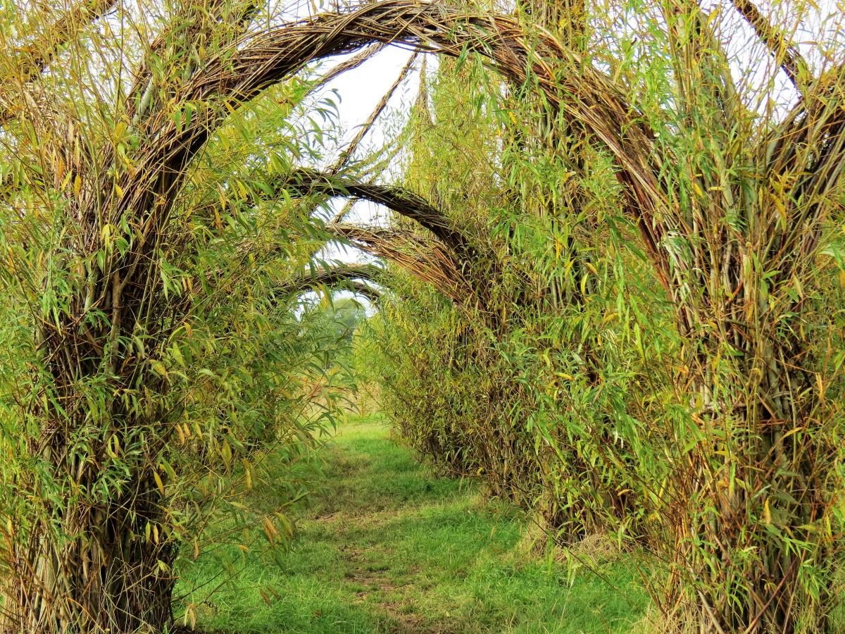
Continuing its meandering course through fields the river flows beneath the three arches of the medieval Hele bridge and on past Fideok Mill and Longaller Mill to reach Bishops Hull where it flows beneath the modern Silk Mills road bridge. Now on the outskirts of Taunton the river flows through Longrun Meadow Country Park with its Willow Cathedral and French Weir Park. The parks are accessed by a series of new footbridges that cross the Tone. Next, after a journey of 45 kilometres, the river arrives at French Weir originally constructed in the 13th century to create the Castle millstream.
Willow Cathedral
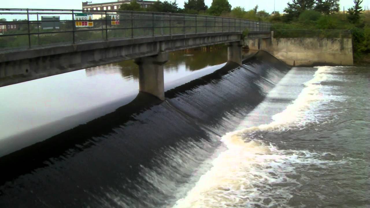
From French Weir the river flows through the centre of Taunton beneath North Town bridge, a three-span steel girder bridge built in 1895 in wrought iron and then via Firepool Weir from where the Bridgwater and Taunton canal was cut and opened in 1827. After Firepool the river reaches Bathpool where the original water course was straightened (the “New Cut”) during the construction of the Bristol and Exeter Railway in the early 1840’s.
The river continues east to the north of Ruishton and south of Creech St Michael where a New Cut was made in 1960 to provide a channel to carry excess water and prevent flooding. (After the floods of 1960 extensive works were carried out downstream of Taunton to deepen, widen and straighten sections of the river).
From Creech the river flows through the wetland of West Moor, Curry Moor, Hay Moor and Hook Moor to Curload in the parish of Stoke St Gregory. The river continues on through Stan Moor and past Athelney and joins the main channel of the River Parrett at Burrowbridge. The Tone is tidal up to the Newbridge Sluice in North Curry Parish.
The river Tone and its tributaries drain an area of 414 square miles. The tributaries include Allen Brook, Back Stream, Halse Water, Hillfarrance Brook in the north of the catchment area and Broughton Brook, Haywards Water, Hele Brook, Sherford Stream and Westford Stream that join from the south.
Source: Elevation 374.7 m or 1229.2 feet – Location :51.09688,-3.40349
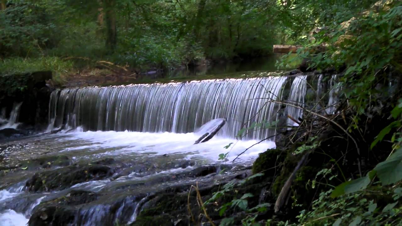
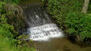
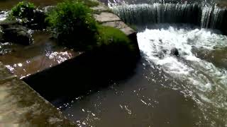
There are a number of weirs through out the course of the river, designed to provide water flow to water wheels and videos of these weirs can be found below.
Tone Navigation
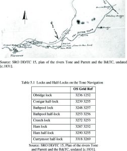
Records indicate that the river Tone was being used for navigation from Bridgwater to Taunton in the mid-fourteenth century but only when the conditions were favourable. To enable the river to be used for navigation on a regular basis improvements were needed for both the river channel and the overall control of the upper reaches of the river. It was thus that in 1638 John Malet requested and was granted a commission to undertake improvements at his own expense to the river as far as Ham Mills. By doing so he gained the sole rights for navigation between Bridgwater and Taunton. He was authorised to levy tolls on the loaded goods that used the waterway.
After John Malet died his son took over the responsibilities and later passed to other family members but they did not share John Malet’s enthusiasm for the upkeep of the river and traders and merchants in Taunton began to show concern for the river’s lack of upkeep. Consequently in 1699 with the backing of The Tone Navigation Act they were authorised to purchase the rights from the Malet family and to establish the Conservators of the River Tone, with powers to “cleanse and keep the said River Tone navigable from Bridgwater to Ham Mills, and thence to the town of Taunton.” The Conservators immediatley commenced works with the repair of “Barpool lock.” and by 1717 the river had been made navigable to Taunton by means of locks and half-locks:
The Conservators held the responsibility until the construction of the Bridgwater and Taunton Canal in 1839 when after a series of legal disputes it was agreed the Bridgwater and Taunton Canal Company would take responsibilty for the upkeep of the Tone Navigation. So after a payment of £2,000 the Canal Company took over the Tone navigation responsibility and as part of the agreement the Conservators retained the right to an annual inspection of the navigation and the right to repossess the river if it was not well maintained. This statutory responsibilty to inspect both the canal and the river in the town remained until 1969.
You can read Hugh P. Olivey’s 1901 summary of J. Savage’s account of the River Tone Navigation taken from his History of Taunton, published in 1822, by clicking Here
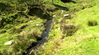
The Little River on Exmoor, a tributary of the River Barle, rises approximately 250 metres south of Spire Cross at an elevation of approximately 350 metres. It then flows in a southerly direction, through Contest Plantation, past Higher Spire and Lower Spire. Just south of Lower Spire a small stream joins from the east, prior to the river flowing beneath the Lower Liscombe Road. From here the river turns in a westerly direction flowing below Varle Hill where a stream from the north which originates near to Lakehead Combe joins. After flowing for a distance of approximately 2.75 kilometres with a fall in elevation of lose to 135 metres it reaches its confluence with the River Barle.
Source: Elevation 350.6 m or 1150.3 feet – Location :51.08850,-3.58928
Video Gallery
The beginnings of Little River on Exmoor near Spire Cross
View More
Winn Brook is a tributary of the of the River Exe.. The source of the Winn Brook is south of Little Ash Farm near Comer’s Gate. From the source it flows in a generally easterly direction flowing below Winsford Hill. It is first joined by waters from Little Ash Combe and then Ash Combe before flowing through Great Ash Wood were it is joined by a further tributary stream. Continuing in an easterly direction it reaches Withycombe where waters from the Punchbowl join. From Withycombe it flows through fields and Burrow Wood to reach the River Exe at Winsford.
It travels for a distance of approximately 5 kilometres from its source to the Exe confluence with a fall in elevation of close to 140 metres.
Source elevation and map coordinates: 332.6 m or 1091.1 feet – Location :51.10631,-3.62449
The river’s source is on the Chains just north of Pinkery Pond at an elevation of approximately 1500 feet. It flows in a northerly direction through Ruckham Combe to the confluence with Warcombe Water just south of South Furzehill. Warnicombe Water rises on Benjami. The river continues its northerly flow through North Furzehill and onto South Sparhanger and the ford at Radsbury Lane. It flows on through Radsbury Copse and Stock Wood to Barbrook. At Barbrook it is joined by it’s main tributary, Barbrook, which rises to the west of the the West Lyn River’s source, close to Woodbarrow Hangings.
Cherry Bridge
Flowing beneath Barbrook Bridge the river flows through Road Wood and Kibsworthy Wood to Lynbridge where it flows beneath Lyn Bridge. Flowing on through Glen Lyn Gorge it reaches it’s confluence with the East Lyn River in Lynmouth. From source to the confluence with the the East Lyn River the river travels approximately 4.8 miles with a full in elevation of close to 450 metres.
Source: Elevation 457.0 m or 1499.3 feet – Location :51.16889,-3.82533
Weir Water rises on Lucott Moor near Lucott Cross and flows in a north westerly direction through the valley on the eastern side of Outer Alscott and Mill Hill. It continues to Weirwood Common where it turns west to Oareford and is joined by Chalk Water to form Oare Water. It flows for a distance of approximately 5 kilometres.
Source: Elevation 436.0 m or 1430.3 feet Location :51.17615,-3.65884
The ordnance survey map suggests that the river has it’s origins in the Treborough headwaters which rise on the northern slopes of the Brendon Hills at an approximate elevation of 386 metres ( 1267 feet ) and after falling 120 metres ( 390 feet ) in the first 600 metres of its journey the headwaters join at Tarr Water Cottages to flow south to Lower Court Farm before turning west to flow to Pooltown. At Pooltown the river is joined by waters that rise on Kennisham Hill which flow north through Colyhill Wood to Upper Pool Cottages, here waters that rise on Langham Hill that flow north through Chargot Woods join. The combined waters flow east past Chargot House before joining the the river at the Pooltown bridge.
Forehill Wood waterfall
From Pooltown the river flows in a northerly direction to Kingsbridge where again it is joined by further waters which originate on Lype Hill. The Lype Hill headwaters flow in a northerly direction through Lype Brake to reach Old Stowey where they turn to the east to flow to the south of churchtown and Luxborough before joining the river upstream of Kingsbridge Bridge.
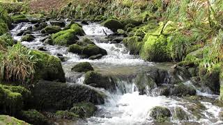
From Kingsbridge the river flows in a generally easterly direction to flow through Druid’s Combe, past Langridge Mills to Roadwater. At Roadwater the Traphole Stream joins the flow. These are substantial waters that rise in the hills above Comberow. One such headwater rises close to The Winding House at the top of the Incline of the West Somerset Mineral Railway. The headwaters above Comberow create spectacular waterfalls. From Comberow the the waters flow in a northerly direction to flow past Pitt Mill before joining the main river in Roadwater.
At Roadwater the river, now complete, flows in a generally northerly direction through Lower Roadwater and Hungerford. From Hungerford the river flows past Cleeve Abbey and then passing through Washford it flows on to reach the sea at Watchet. The approximate length of the river from source to mouth is 10.50 miles.
Source: Elevation 386.2 m or 1267.0 feet – Location :51.10861,-3.43394
Sherdon Water, called Kinsford Water. in its upper reaches is a main tributary of the River Barle. It rises on Comerslade above Kinsford Gate and flows in a generally south easterly direction below Hangley Cleave to Long Holcombe from where it then becomes Sherdon Water. From Long Holcombe it flows south below Sherdon Farm where waters join from Barkham and Sanyway. Turning to a northerly flow it flows through Woolcombe Allotment to reach Lower Sherdon where it flows beneath a three arch stone bridge called Sherdon bridge. Continuing in a northerly direction it flows past Ferny Ball to reach the River Barle at Sherdon Hutch.
From Long Holcombe to its confluence with the Barle it travels for a distance of approximately 4 kilometres and together with Kinsford Water the distance travelled is approximately 10 kilometres. The fall in elevation from Long Holcombe is close to 50 metres and from Comerslade, the source of Kinsford Water, the fall is close to 170 metres.
Source: Elevation 447.6 m or 1468.5 feet – Location :51.12014,-3.80557