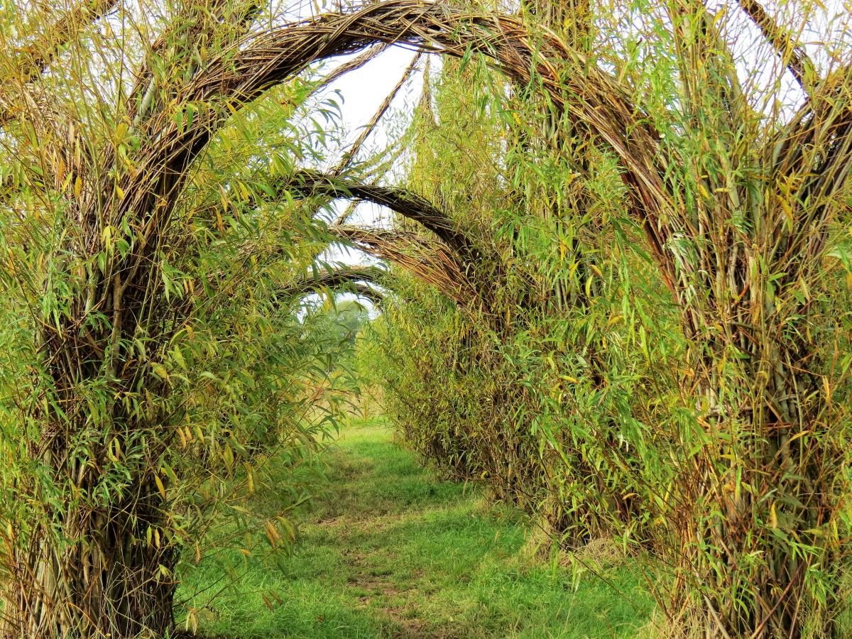
From its source to the confluence with the River Parrett, the river is about 63km long and falls 367 metres. The two main sources of water form two significant valleys, one rises at Beverton Pond in Huish Champflower and is considered to be the source of the Tone. A second stream, rising in Elworthy parish, was in the 13th century known as the Tan, which may dispute Beverton Pond as the source. Beverton Pond is located in the Brendon Hills on the very edge of Exmoor National Park and from this point the river flows southeast through a wooded narrow valley into Clatworthy reservoir. The reservoir was built between 1957 and 1959 and officially opened in 1961, the lake has a surface area of approximately 49 hectares. It is around 3 kilometres from the Tone’s source with a drop in elevation of close to 137 metres.
From the reservoir the river flows south past the settlement of Huish Champflower, and continues south for 12 kilometres within a steep sided wooded valley to flow beneath Waterrow bridge where the river’s elevation is now 146 metres. It’s course continues south and flows beneath the remains of the Tone Viaduct built by Brunel in 1870 to carry the Great Western Railway and then flows beneath Hagley Bridge and Tuck Bridge to reach Stawley Mill. After Stawley the river arrives at Tracebridge where there was a slate quarry. The slate was transported via a small tramway which ran through a tunnel from the quarry to the River Tone. A weir was constructed c.1894 and a short leat ran from the river to a slate cutting sheds and a low breast waterwheel which provided the power for four sawbeds and planing machine which survived until 1940. (Eric Rodwell Tracebridge. A History of the Hamlet, its Houses, The Quarries and the Mill.)
After a journey of close to 20 kilometres the river changes course and turns north to flow past Cothay Manor and beneath Greenham bridge, the elevation here is now close to 80 metres. After flowing north for approximately 4 kilometres the river’s course turns to a generally easterly direction at Lutley Bridge, and meanders through open fields past Wellisford Manor and Harpford bridge, and having now travelled around 30 kilometres reaches Tone. The river at Tone was used by the Fox family for almost 200 years to provide the power for Tone Works which was used as the cloth finishing and dyeing works for Tonedale Mills.

Continuing its easterly direction the river flows beneath the impressive Nynehead Court three arched bridge, an English Heritage listed building before reaching the old Aqueduct that once carried the Grand Western Canal across the river. After flowing beneath Picking’s bridge which carries the Great Western Railway it reaches Bradford on Tone where it flows beneath the two arches of the Sheduled Ancient Monument, the 15th century Bradford bridge. The river is now 37 kilometres from its source with an elevation of 37 metres.
Continuing its meandering course through fields the river flows beneath the three arches of the medieval Hele bridge and on past Fideok Mill and Longaller Mill to reach Bishops Hull where it flows beneath the modern Silk Mills road bridge. Now on the outskirts of Taunton the river flows through Longrun Meadow Country Park with its Willow Cathedral and French Weir Park. The parks are accessed by a series of new footbridges that cross the Tone. Next, after a journey of 45 kilometres, the river arrives at French Weir originally constructed in the 13th century to create the Castle millstream.
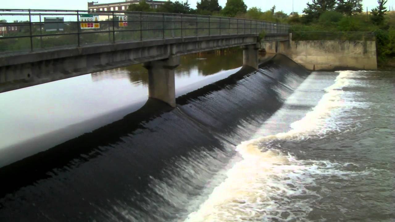
From French Weir the river flows through the centre of Taunton beneath North Town bridge, a three-span steel girder bridge built in 1895 in wrought iron and then via Firepool Weir from where the Bridgwater and Taunton canal was cut and opened in 1827. After Firepool the river reaches Bathpool where the original water course was straightened (the “New Cut”) during the construction of the Bristol and Exeter Railway in the early 1840’s.

The river continues east to the north of Ruishton and south of Creech St Michael where a New Cut was made in 1960 to provide a channel to carry excess water and prevent flooding. (After the floods of 1960 extensive works were carried out downstream of Taunton to deepen, widen and straighten sections of the river).
From Creech the river flows through the wetland of West Moor, Curry Moor, Hay Moor and Hook Moor to Curload in the parish of Stoke St Gregory. The river continues on through Stan Moor and past Athelney and joins the main channel of the River Parrett at Burrowbridge. The Tone is tidal up to the Newbridge Sluice in North Curry Parish.
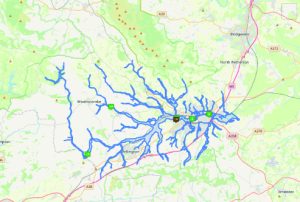
The river Tone and its tributaries drain an area of 414 square miles. The tributaries include Allen Brook, Back Stream, Halse Water, Hillfarrance Brook in the north of the catchment area and Broughton Brook, Haywards Water, Hele Brook, Sherford Stream and Westford Stream that join from the south.
Source: Elevation 374.7 m or 1229.2 feet – Location :51.09688,-3.40349
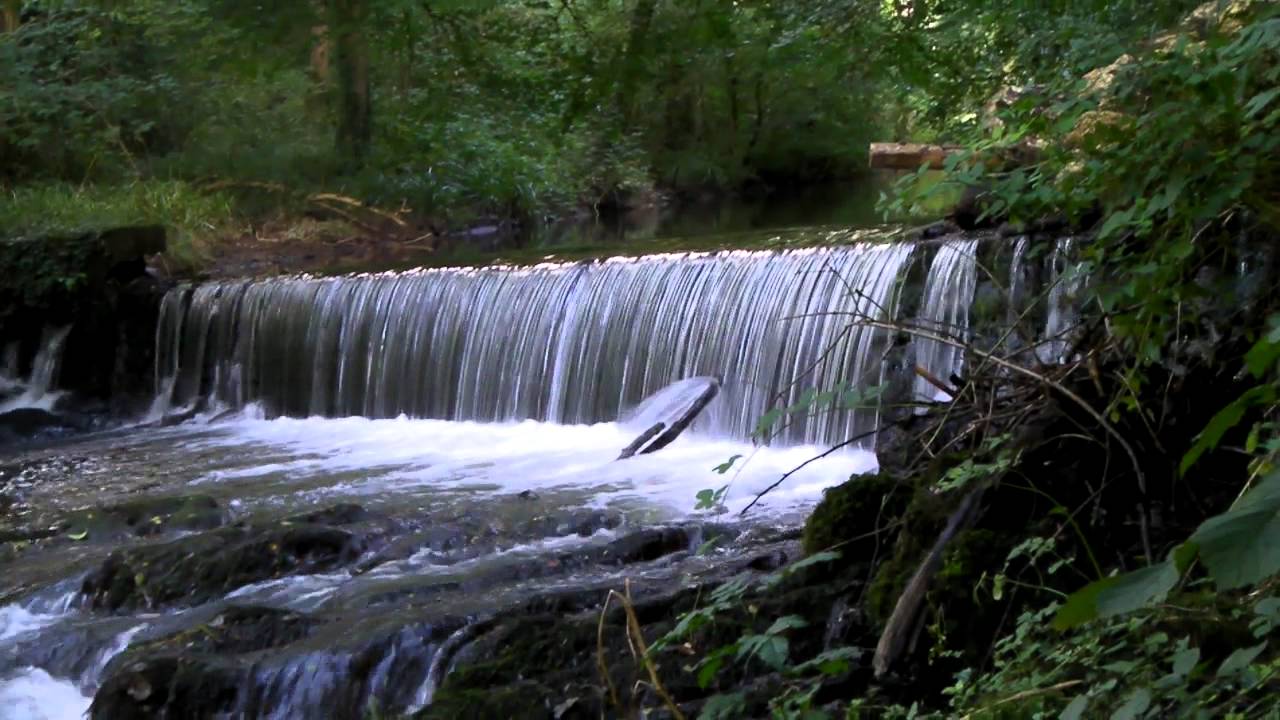
There are a number of weirs through out the course of the river, designed to provide water flow to water wheels and videos of these weirs can be found below.
Tone Navigation
Records indicate that the river Tone was being used for navigation from Bridgwater to Taunton in the mid-fourteenth century but only when the conditions were favourable. To enable the river to be used for navigation on a regular basis improvements were needed for both the river channel and the overall control of the upper reaches of the river. It was thus that in 1638 John Malet requested and was granted a commission to undertake improvements at his own expense to the river as far as Ham Mills. By doing so he gained the sole rights for navigation between Bridgwater and Taunton. He was authorised to levy tolls on the loaded goods that used the waterway.
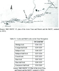
After John Malet died his son took over the responsibilities and later passed to other family members but they did not share John Malet’s enthusiasm for the upkeep of the river and traders and merchants in Taunton began to show concern for the river’s lack of upkeep. Consequently in 1699 with the backing of The Tone Navigation Act they were authorised to purchase the rights from the Malet family and to establish the Conservators of the River Tone, with powers to “cleanse and keep the said River Tone navigable from Bridgwater to Ham Mills, and thence to the town of Taunton.” The Conservators immediatley commenced works with the repair of “Barpool lock.” and by 1717 the river had been made navigable to Taunton by means of locks and half-locks:
The Conservators held the responsibility until the construction of the Bridgwater and Taunton Canal in 1839 when after a series of legal disputes it was agreed the Bridgwater and Taunton Canal Company would take responsibilty for the upkeep of the Tone Navigation. So after a payment of £2,000 the Canal Company took over the Tone navigation responsibility and as part of the agreement the Conservators retained the right to an annual inspection of the navigation and the right to repossess the river if it was not well maintained. This statutory responsibilty to inspect both the canal and the river in the town remained until 1969.
You can read Hugh P. Olivey’s 1901 summary of J. Savage’s account of the River Tone Navigation taken from his History of Taunton, published in 1822, by clicking Here
Image Gallery Location Map Structures